
Is Noah’s Ark on Mount Ararat?
The search for the real Noah's Ark, proposed locations, issues with Mount Ararat, and what may have happened to the Ark from a geologist
by
Dr. Andrew A. Snelling
on
May 1, 2017; last featured
August 24, 2021
Featured in Answers Magazine
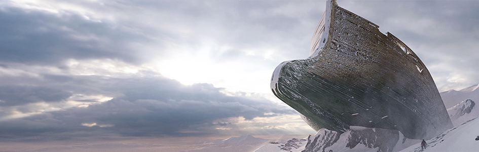
Despite multiple expeditions over many centuries, Noah’s Ark still has not been found. A geologist proposes one reason why.
Of all the famous “lost” artifacts yet to be found, Noah’s Ark tops the list in many people’s minds.
From Hong Kong to Holland, the world is fascinated by Noah and the Ark. This isn’t surprising because so many cultures have ancient Flood stories. Though distorted in the details, many of these stories seem to reflect the true account in Genesis 6–9.
This fascination is also bringing people in droves from around the globe to the life-sized Ark replica at the Ark Encounter in northern Kentucky.
At the same time, several teams have continued searching for the real Ark. Most of them have focused on Mount Ararat in northeastern Turkey, where eyewitness accounts of a wooden structure have spurred interest for centuries. With such a large vessel and so much interest, why hasn’t it been found?
Perhaps we need to look again at the account in God’s Word. It says that the Ark landed on the “mountains of Ararat” on the 150th day of the Flood (Genesis 8:4). This was a region, not a single mountain.
Furthermore, explorers have overlooked the geological makeup of this region in their age-old quest for Noah’s Ark. How were the rocks and strata in this region formed and changed during the Flood and in the years afterward?
The biblical reference to “mountains of Ararat” as the landing site of the Ark suggests those mountains formed well before the Flood ended. The Flood was a global catastrophe that totally reshaped the earth’s geology, and the earth’s surface has continued to change since then. Perhaps the geology of the modern Mount Ararat region sheds light on whether we should be looking for Noah’s Ark on that mountain.
The Search for Noah’s Ark
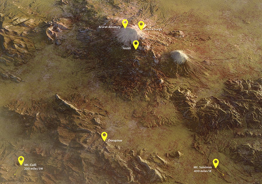
Since the 1800s, several dozen expeditions have scaled Mt. Ararat in hopes of finding evidence of Noah’s Ark, and more are planned in the coming years. Satellite imagery and aerial photographs have generated interest in several sites. Most excursions have focused on a handful of locations based on earlier reported sightings.
Ararat Anomaly
A US Air Force reconnaissance plane took black-and-white images of the northwest side of Mt. Ararat in 1949, revealing a large object that resembles a portion of a ship. The images were made public in 1995 and sparked further interest.
Ahora Gorge
One mile below the peak of Ararat is Ahora Gorge. This site gained popularity when George Hagopian, an Armenian, claimed his uncle took him on top of the Ark as a young boy around 1908. Throughout his lifetime, he proclaimed what he discovered as truth, but he was unable to pinpoint the exact location of his discovery.
Undisclosed NAMI Site
A Turkish guide, Ahmet Ertugrul, supposedly found compartments from the Ark’s interior on the south side of Mt. Ararat. He took photographs in 2008 and reported them to NAMI, a Hong Kong-based ministry.
Durupinar
Heavy rains exposed a large “Ark-shaped” formation in 1948, approximately 15 miles from the summit of Mt. Ararat. A 1960 expedition found only dirt and rocks, but explorer Ron Wyatt went back in the 1970s and 1980s, claiming he found an outline of metal fittings using a “frequency generator.”
Mount Cudi/Judi
Some ancient writers said people could still see the Ark in New Testament times at Mt. Cudi. An expedition found wood in 1953, encouraging further expeditions.
Mount Suleiman
A veteran named Ed Davis claimed he saw the remains of Noah’s Ark while he was stationed in Iran during World War II. Later expeditions claimed to find beam-like rocks on Mount Suleiman
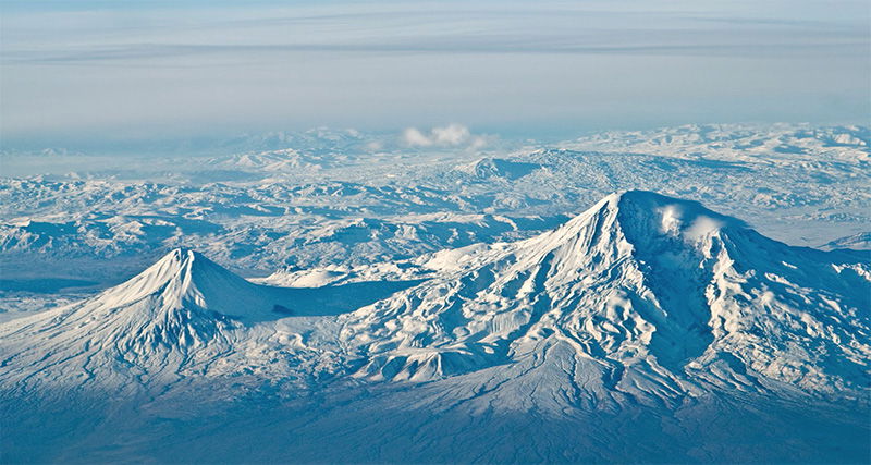
Mount Ararat—The Volcano and Its Geology
Mount Ararat is technically known as a stratovolcano. That’s a cone-shaped volcano which builds progressively from a central vent that erupts many times and deposits successive layers of lavas and volcanic ash on the flanks of the growing edifice.
Modern Mount Ararat actually consists of two stratovolcanoes—Greater Ararat and Lesser Ararat—that rise above a high plain which is itself over 5,000 feet (1500 m) above sea level. The summit of Greater Ararat is 16,854 feet (5137 m) above sea level, while Lesser Ararat, just 8 miles (13 km) to the east of it, is only 12,782 feet (3896 m) high. Together they cover a massive area of 420 square miles (1090 km2), and have been estimated to consist of a whopping 280 cubic miles (1170 km3) of lavas and volcanic ash. When did this monstrosity form?
It is a dormant volcano today, but it was active until recently. A steam-blast eruption and volcanic ash flow opened on the upper north flank of Greater Ararat on July 2, 1840, accompanied by an earthquake of estimated magnitude 7.4. The cloud of steam and ash, and a humongous landslide, utterly devastated a monastery and villages in their path.
Earlier Ararat eruptions are known from oral history and archaeological excavations. These occurred in AD 1783 and 1450, around 550 BC, and another time even earlier.
Glaciers and avalanches have eroded canyons in the flanks of the volcano, exposing its internal layers and enabling geologists to do detailed field work to establish when and how Mount Ararat formed.
The volcano grew in four major stages: the pre-cone, cone-building, climactic, and flank eruption phases. At its base is a 2,300-foot-thick (700 m) sequence of volcanic ash layers deposited by violent eruptions during the pre-cone phase. Then eruptions from two central vents—spewing some 1,800 feet (550 m) of lava and volcanic ash flows—built the two cones. In the climactic phase, lava flowed copiously to add another 2,700 feet (820 m) to the cones. Finally, lavas and volcanic ash erupted from cracks in the flanks.
The Geology Underneath Mount Ararat
But what rocks are underneath the Ararat volcanoes? Again, careful field work has demonstrated that many layers of earlier volcanic rocks spread right across the whole Erzurum-Kars Plateau of eastern Turkey (see map, below). Many violent eruptions had to take place before Mount Ararat was built on top of this plateau.
Under the Volcano
Mount Ararat is a young volcano located in a very unstable region. Underneath and surrounding it is a huge plateau that formed when colliding tectonic plates caused massive lava flows to cover more than 20,000 square miles (50,000 km2). Ararat is only one-fiftieth of this area, a dot in comparison, which arose later. Could Noah’s Ark really be here?
- Flood Sediments, at least 13,800 feet (4200 m)
Deep under Mount Ararat are thousands of feet of Flood sediments, filled primarily with marine fossils from the destruction of life in the ocean and on land. These are similar to Flood layers we find all over the earth. - Lava Flows, about 650 to 2,600 feet (200–800 m)
Above the Flood layers are thick lava flows. These covered the region sometime after the Floodwaters drained off the earth. They built up over a few years, and included between the flows are thin deposits of localized lake sediments with fossils of buried freshwater fish. - Young Volcano
Mount Ararat is a stratovolcano, which arose some time after lavas had covered the region. It grew as lava flowed out of two vents, progressively building layers of lavas and ash on their slopes, spreading on top of the plateau’s lava layers.
Beneath these volcanic layers is a thick sequence of rocks that formed when ocean waters flooded the area and laid down sediments filled with billions of ocean creatures, such as brachiopods (lamp shells), corals, clams, and ammonites.
These marine invertebrate fossils appear in the same relative order we find in other places around the world. The lower section of this sequence of sedimentary layers has fossils similar to other Devonian-Permian (Paleozoic) layers, which creationists believe were deposited globally early in the Flood. Above them are Triassic-Cretaceous (Mesozoic) layers, which were deposited later in the Flood, at the same time as the dinosaur fossils. Then at the top of this sequence, Eocene-Lower Miocene (or Cenozoic) layers were deposited before the ocean waters fully receded.
After Noah’s ark had landed and the floodwaters had retreated, volcanic eruptions spread lava across the region and then built Mount Ararat on top.
The lavas of the Erzurum-Kars Plateau were deposited on top of these sedimentary layers and are more recent.1 Confirming that this plateau was formed post-Flood are the minor localized sediment layers containing continental (land) fossils deposited by local freshwater rivers and lakes. These sediment layers were deposited between the many lava flows that formed the plateau. Deposition had almost finished before Mount Ararat began to grow above the plateau.
Mount Ararat was thus not built under water. The volcanic eruptions that spread lava across the Erzurum-Kars Plateau and then built Mount Ararat began after the Flood deposited all the ocean sediments. That means the ocean waters had already retreated from off eastern Turkey (and Noah’s Ark had landed) before Mount Ararat was built.
Mount Ararat in the Biblical Chronology
All these details are vital for placing the formation of Mount Ararat within the biblical chronology. This in turn answers whether Noah’s Ark is on Mount Ararat.
God’s Word clearly says that the Ark landed on the “mountains of Ararat” on the 150th day of the Flood (Genesis 8:4). By that stage, the waters had prevailed to cover the whole earth (Genesis 7:19–24). The ocean (Flood) waters did not retreat until after the Ark landed safely.
However, the volcano now called Mount Ararat did not grow until well after the ocean (Flood) waters had retreated. Furthermore, the lavas and ash layers of Mount Ararat date to the time of the post-Flood Ice Age. This is consistent with Mount Ararat being built after the Flood on top of a dry plateau. Mount Ararat is thus a post-Flood volcano, which continued to erupt, most recently less than 200 years ago.
Modern Mount Ararat consists of two stratovolcanos, Lesser Ararat and Greater Ararat. Both were built up by volcanic eruptions after the Ark had already landed.
Thus, from my perspective as a biblical geologist, I do not expect to find Noah’s Ark on Mount Ararat. Instead, it must have landed on another high mountain in the region at that time.
Does this shake my faith in God’s Word as a reliable account of the historic global Flood cataclysm? Absolutely not! The Bible clearly states the “mountains of” Ararat, not “Mount Ararat” itself. So I’m even more confident in its trustworthiness, not less so. Also, we should not need remnants of Noah’s Ark to justify or bolster our faith.
God’s Word is absolutely true in every detail because God is its author. “The entirety of Your word is truth” (Psalm 119:160). Even without finding the Ark, there is overwhelming geologic evidence that the Flood occurred, just as God’s Word describes. The field of geology is just one of many tools that God gave us to explore His handiwork and to show others why our faith is so reasonable and exciting.
Noah’s Ark Found
Or has it been? Take a brief look at popular claims of discovery.
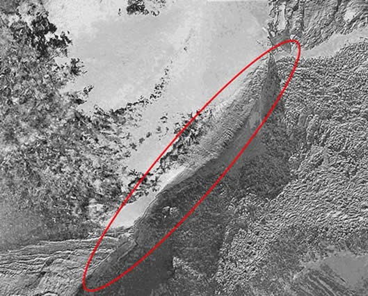
Ark-Like Outcrop
This satellite image from 2003 shows an Ark-shaped object jutting out of the side of Ararat. Investigators were hoping to get a better image of an original grainy photograph, taken by a plane in 1949. That photograph showed a large structure jutting out of the ice and snow, known as the Ararat Anomaly. It is difficult to determine the object’s size or whether the images were taken at the same site.
Some Ark hunters hope this might be their next big break, but geologists say the object simply looks like a rock outcropping that only appears ark-like when snow and ice melt in the right spots. To date, the Turkish government has not permitted an expedition to explore the site.
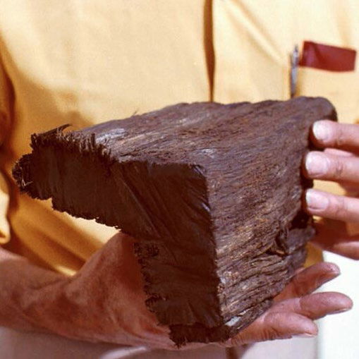
Beam from the Ark
A 1993 CBS program, The Incredible Discovery of Noah’s Ark, featured a Frenchman who reported he found a wooden beam in a crevasse on Ararat and saw a large, dark object under the ice in 1955. Fernand Navarra’s son shot black-and-white film footage of his father carrying the beam down the mountain.
The program described the wood’s radiocarbon age as 5,000 years, but testing by six labs concluded the wood was less than 2,000 years old. Also, members of the expedition said that Navarra purchased the wood in town and carried it up the mountain before he “discovered” it.
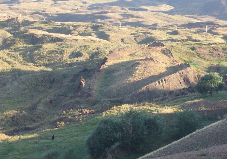
Ark-Shaped Formation
Earthquakes and heavy rain exposed a large Ark-shaped formation in 1948. The site, named Durupinar, was designated a national park in Turkey and is easier to get to than all the other main Ark locations. Ron Wyatt claimed to have found multiple artifacts in the area to bolster his assertion that the object is indeed the Ark.
However, geologists and archaeologists have studied the site and rejected it, concluding it is merely one of many similar geologic formations in the region. Many of these researchers were Christians who would love to find the Ark, but the evidence was lacking.
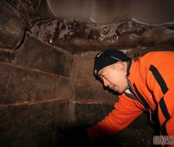
Interior of the Ark
After a Turkish guide claimed to discover interior compartments of the Ark, a Hong Kong ministry, NAMI, sent a team to the site. In 2010 the team announced that they had recovered wooden specimens, which they believe were part of the Ark. They produced a video and shared several photos of team members inside the structure.
Evidence of possible fraud was rife. The Kurdish man who led the team did not allow the team’s experts to visit the site, and the research and reports had numerous inconsistencies. Further reports of visits to this site, including claims of the discovery of archaeological artifacts there, are vague. Radiocarbon dating of wood claimed to come from this site yielded ages that are far too recent to be from the Ark. Some pieces are even dated as modern wood, and some have machining marks that appear to be from modern wood planers (visible in the photograph).
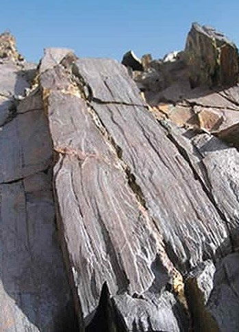
Beam-Shaped Rocks
In 2006, Bob Cornuke led a team of 14 Americans to visit a region in Iran where a World War II veteran claimed he saw the Ark. At Mount Suleiman the team claimed to have visited an object 13,000 feet above sea level, which had the appearance of blackened petrified wood. Cornuke’s organization, the BASE (Bible Archeology Search and Exploration) Institute, identifies this site as the one the veteran saw.
Despite these assertions, geologists say the beam has all the appearances of a common geologic formation—when fine layers of rock are upended and eroded. But BASE did not do any lab testing.
Will Noah’s Ark Ever Be Found?
Based on the fact that Mount Ararat rests upon volcanic strata on top of sediments laid down by the Flood, we can be rather confident that the Ark will never be found on this mountain. But should we expect to find Noah’s vessel elsewhere? As amazing as it would be to find the famous Ark, the following details make such a scenario highly unlikely.
Repurposed Lumber
The Ark may have been repurposed after the Flood. Immediately following the Flood, wood for construction and fires might not have been readily available for several years. Noah’s family may have torn down much of the structure for these purposes.
Decay Over Time
Wooden structures do not generally last for centuries even if treated with pitch. Consider the condition of barns built 100–200 years ago. Without regular upkeep, they eventually collapse and then disappear because of decay and harsh conditions.
Glacial Movement
Freezing has its share of problems. Some have proposed that the Ark is trapped in a glacier, thus preserving the wood from decay. However, glaciers advance and recede. Such movement would tear the Ark to shreds.
holds a PhD in geology from the University of Sydney and has
worked as a consultant research geologist in both Australia and America. Author of numerous
scientific articles, Dr. Snelling is now director of research at Answers in Genesis–US.
Answers Magazine
May–June 2017
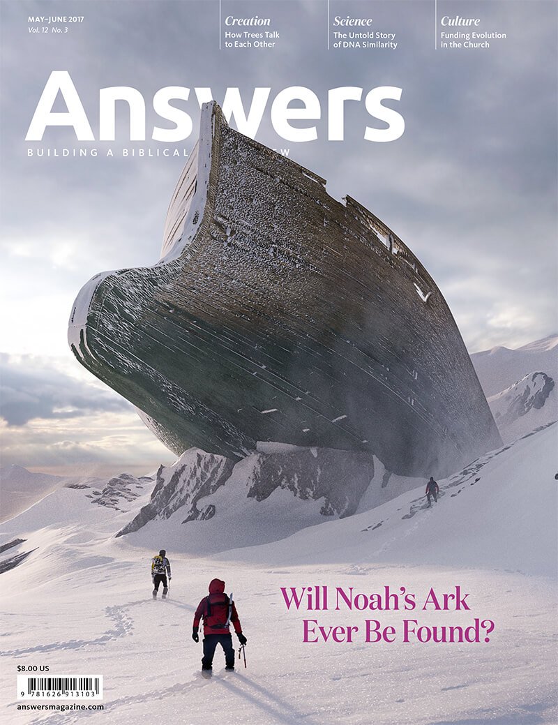
The greatest archaeological mystery of our time may have answers from an unexpected source . . . volcanic rocks.
Browse Issue SubscribeFootnotes
- The lavas in the plateau have been dated by the potassium-argon radioactive method as upper Miocene. The oldest lavas of the pre-cone phase of Mount Ararat yield even more recent dates, equivalent to during the post-Flood Ice Age. These dates are accurate only in a relative sense, but are mistaken in an absolute sense because of the unbiblical assumptions involved in the methodology. In this instance, the relative dates match the order of eruption of these lavas.


Support the creation/gospel message by donating or getting involved!

Answers in Genesis is an apologetics ministry, dedicated to helping Christians defend their faith and proclaim the good news of Jesus Christ.
- Customer Service 800.778.3390
- © 2024 Answers in Genesis