
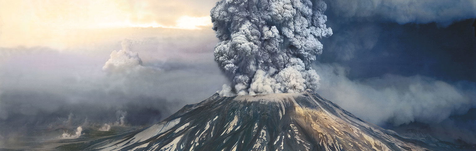
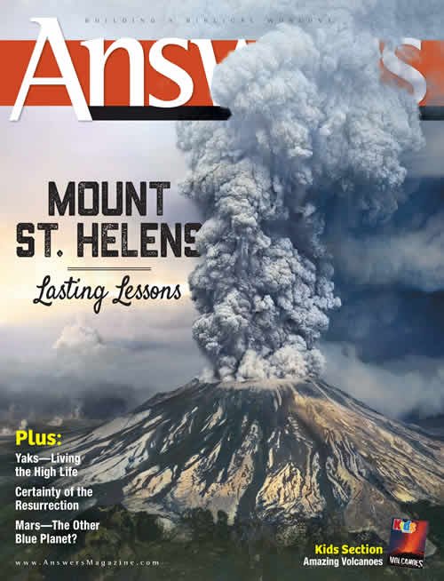
photo: USGS; colorization by Sanna Dullaway
Lasting Lessons from Mount St. Helens
by
Dr. Andrew A. Snelling, Dr. Joe Francis,
and
Tom Hennigan
on
April 1, 2015
Republished with permission and featured in
Answers Magazine
The eruption of Mount St. Helens 35 years ago provided an amazing opportunity for scientists to study the effects of catastrophe. The incredible lessons are as valuable as ever!
May 18, 2015, marks the 35th anniversary of one of the most violent natural disasters of our modern time, the colossal 1980 eruption of Mount St. Helens in Washington state. Its explosive power shocked the world and made headline news. Fifty-seven people died, over $1 billion worth of property was destroyed, and over 230 square miles (600 km2) of forests were immediately flattened. Recent rumblings are again making news, raising fears that the volcano may be reawakening.
While the losses were tragic, the value to science has been inestimable. Geologists vastly improved their ability to predict eruptions, safely evacuating tens of thousands of Filipino people before Pinatubo erupted in 1991. Scientists began learning many other valuable lessons, some of which have challenged the foundations of evolutionary thinking.

Copyright Bettmann/Corbis / AP Images
Harry R. Truman, who operated a lodge near Mount St. Helens for over fifty years, became a folk hero when he refused to evacuate. “The mountain is a mile away,” he told reporters. “The mountain ain’t gonna hurt me.” He and his lodge were later buried under 150 feet (46 m) of debris.
The eruption of Mount St. Helens is often regarded as the most significant geologic event of the twentieth century. Since the volcano was conveniently located in Washington state, only two hours’ drive from Portland, scientists could document the eruption in unprecedented detail. Although not the most powerful explosion on record, it provided a natural laboratory for understanding how quickly catastrophic processes can reshape the earth, and how rapidly wildlife can recover.
Within moments of eruption, the whole northern side of the mountain (two-thirds of a cubic mile of rock) slid away—the largest observed landslide on record. The eruption lasted nine hours, followed by more eruptions over the next six years. Geologists, who are accustomed to thinking about slow evolutionary processes shaping our world, were astounded by the scale of initial destruction and the speed at which new geologic features formed. Thirty-five years later, Mount St. Helens still teaches us lessons about the powerful forces the Creator used to shape the earth. These findings confront the underlying slow-and-gradual assumptions of modern geologic thinking, and they give us invaluable clues about the catastrophic potential of a global, cataclysmic Flood.
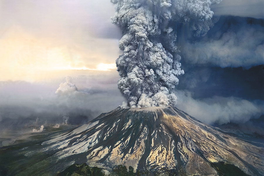
May 18, 1980, 8:32 am
A magnitude 5.1 earthquake shook Mount St. Helens, triggering a colossal eruption. Pulverized ash blasted up to 16 miles into the atmosphere, and within a few minutes about 230 square miles was devastated.
May 18, 1980, 8:32 am
A magnitude 5.1 earthquake shook Mount St. Helens, triggering a colossal eruption. Pulverized ash blasted up to 16 miles into the atmosphere, and within a few minutes about 230 square miles was devastated.
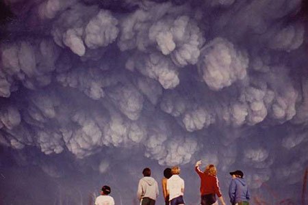
Ash Cloud
by Andrew A. Snelling
On May 18, 1980, at 8:32 am the initial blast of steam—equivalent to 20 megatons of TNT—destroyed the northern side of the once pristine cone-shaped volcano. Within a few minutes an area of about 230 square miles (600 km2) was devastated. The total energy output during the subsequent nine-hour eruption was equivalent to 440 million tons of TNT, approximately 33,000 Hiroshima atomic bombs. That’s about one such atomic bomb exploding every second for nine hours!
More than two-thirds of a cubic mile (2.8 km3) of rock was ejected and pulverized to ash, which blasted up to 16 miles (26 km) into the atmosphere. The ash-cloud stem was 10 miles (16 km) wide, and the mushroom top was 40 miles (64 km) wide and 15 miles (24 km) high. Winds in the atmosphere dispersed the ash eastward at 60 mph (100 km/h), blanketing 11 states and several Canadian provinces with dust. Some towns were engulfed in complete darkness at midday.
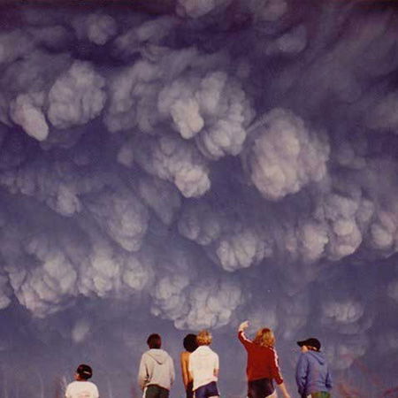
photo Carmen R. Andrews
May 19, 1980
Students on a field trip near Vantage, Washington, were surprised when a cloud of ash suddenly roared over their heads two hours after the eruption.
Lesson about Catastrophe
Even though this ash cloud was small in comparison to the whole earth, it still managed to cool the earth a fraction of a degree.
Application to the Creation Model: Rapid Ice Age Cooling
The earth’s rock layers show abundant evidence of a huge number of massive volcanic eruptions throughout the closing stage of the Flood and in the years immediately following the Flood. These eruptions dwarfed Mount St. Helens. (An eruption at Yellowstone, for example, was one thousand times as big as that of Mount St. Helens!) So if the comparatively small Mount St. Helens eruption could cool the earth, it is easy to see how multiple volcanic eruptions after the Flood contributed to the rapid onset of the Ice Age.

photo © Steve Austin
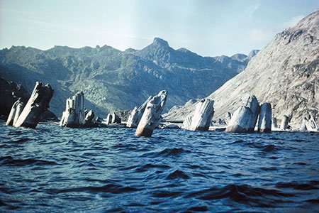
September, 1982
By late afternoon, over one million logs were floating on Spirit Lake. In September 1982, the first scientists to reach Spirit Lake by road found upright floating logs.
photo © Steve Austin
September, 1982
By late afternoon, over one million logs were floating on Spirit Lake. In September 1982, the first scientists to reach Spirit Lake by road found upright floating logs.
Vertical Floaters
by Andrew A. Snelling
The volcanic blast of May 18, 1980, traveling at an initial speed of over 650 miles per hour (300 m/sec.), destroyed the forests in the surrounding 230 square miles (600 km2) within ten minutes! Douglas firs as tall as 200 feet (61 m) were instantly stripped of their branches and snapped like toothpicks.
As the side of the volcano slid into nearby Spirit Lake, it pushed a wave of water into the neighboring forest, dragging many logs back into the lake. By late afternoon over one million logs were floating on the lake. Many were actually floating upright. Even though the roots were broken off, the bases were still thicker and denser, causing the logs to float upright.
Many logs subsequently sank to the floor of the lake, still upright but rootless. Indeed, it was estimated that 20,000 upright, fully submerged logs were sitting on the floor of the lake by August 1985. They looked like a forest of trees buried in mud. Radar and scuba divers found that many logs had become buried by more than 3 feet (1 m) of sediment, while others were still resting on the floor of the lake.
(image adapted from the original by ICR)
The eruption knocked down the nearby forests, and many of the tree stumps ended up in Spirit Lake. Many logs floated upright before they sank, forming deposits of rootless tree stumps similar to “petrified forests” in places like Yellowstone National Park.
Lessons about Catastrophe
In just five years, many layers of upright trees were buried. If geologists had never observed what actually happened, they could easily have misinterpreted these upright buried logs as representing multiple forests that grew at different periods over many thousands of years. This is, in fact, how they interpret the petrified upright logs at Specimen Ridge in Yellowstone National Park.
Application to the Creation Model: Petrified “Forests” and Polystrate Fossils
Many of the petrified logs at Yellowstone are upright and missing their roots like the ones at Mount St. Helens. This shows that the fossilized upright logs in so-called “petrified forests” could have come from logs that were floating during and after the Flood and sank to be buried upright in sediments. This phenomenon would explain another type of fossilized upright logs called polystrate fossils, which penetrate multiple sedimentary layers. These, too, must have been floating on the Flood waters and buried rapidly in Flood sediments.
Bark Peat
by Andrew A. Snelling
The enormous log mat floating on Spirit Lake lost its bark and branches, rubbed off by the abrasive action of wind and waves. Scuba investigations of the lake bottom subsequently revealed that sheets of bark intermingled with volcanic sediments had formed a layer of peat more than 3 feet (1 m) thick. Together with broken branches and root materials, the sheets of bark gave the peat a coarse texture and a layered appearance. This “Spirit Lake peat” resembles, both compositionally and texturally, certain coal beds of the eastern United States.
Lessons about Catastrophe
The “Spirit Lake peat” accumulated in just five years. The Spirit Lake peat is texturally and compositionally similar to the coarse content of coal beds, which secular geologists believe require many thousands of years to accumulate.
Application to the Creation Model: Rapid Coal Beds
Many geologists claim that coal beds formed by the very slow accumulation of organic material in vast swamps where the plants grew in place. By slow accumulation, they estimate about 1,000 years was required to form each inch of coal. However, the texture of coal doesn’t match what we find in typical swamp peat today. Swamp peat is very fine, with a texture looking like coffee grounds or mashed potatoes. The roots of the plants growing in the swamps break up the bark, making the peat homogenous. We may find large root material in modern swamp peat, but sheets of bark are extremely rare.
The lesson from Spirit Lake is that coal beds can and do form rapidly, due to catastrophic destruction of forests, not the slow and gradual growth of plants in swamps. The Flood would have destroyed the earth’s forests in a matter of weeks, and the floating, jostling logs would produce bark that then sank to form most of the earth’s coal layers.
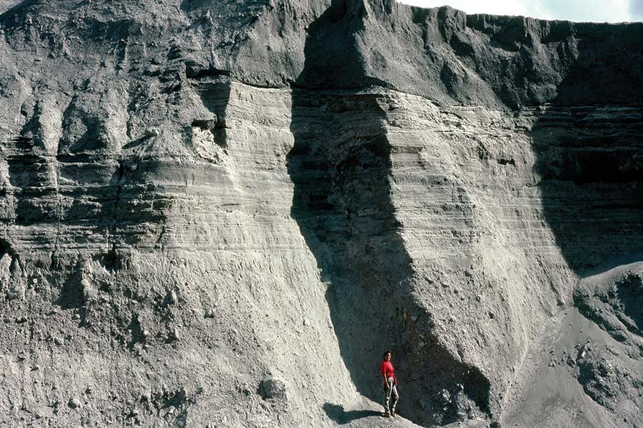
photo © Steve Austin
June 12, 1980
Volcanic ash flows, moving at nearly 90 mph (150 km/h), deposited a layered volcanic ash bed 25 feet (7.6 m) thick within only 3 hours.
photo © Steve Austin
June 12, 1980
Volcanic ash flows, moving at nearly 90 mph (150 km/h), deposited a layered volcanic ash bed 25 feet (7.6 m) thick within only 3 hours.
Pyroclastic Deposits
by Andrew A. Snelling
The eruptions at Mount St. Helens triggered several different earth-shaping forces. The original blast of air was followed by landslides, volcanic ash flowing on the ground, mudflows, steam water, and falling volcanic ash. Even the water in nearby Spirit Lake was temporarily pushed out of its basin and came crashing back into place. These catastrophes produced complex sediment layers up to 600 feet (180 m) thick.
Mount St. Helens emphatically teaches us that sedimentary layers form very rapidly.
The most surprising accumulations resulted from several slurries of volcanic ash that moved out from the volcano at velocities estimated up to 80 miles per hour (130 km/h). These deposits were filled with different layers, including many fine volcanic ash beds ranging in thickness from a tiny fraction of an inch (a few mm) to 3 feet (1 m). Each bed was laid in just a few seconds to several minutes.
One such layered deposit—25 feet (7.6 m) thick—accumulated within only three hours during the evening of June 12, 1980. It came from volcanic ash flows moving at a hurricane velocity of 90 miles per hour (150 km/h). Geologists were staggered that so many varied sediment layers (both fine and coarse, containing thin horizontal layers [laminae], cross-bedding, and graded bedding) could be produced by a slurry moving at more than freeway speed.
Lessons about Catastrophe
Sadly, most conventional geologists still think that such complex sedimentary layering can only occur slowly with the changing seasons or annual fluctuations. If a catastrophe formed these deposits, they assume the energy would break each one down into similar, homogenized materials rather than a mixture of coarse and fine grains.
Application to the Creation Model: Rapid Sedimentary Layers
Mount St. Helens emphatically teaches us that sedimentary layering does form very rapidly by catastrophic flow processes, such as those which occurred during the Genesis Flood. Though slurries of volcanic ash behave a little differently from waterborne mud, the processes are essentially the same.
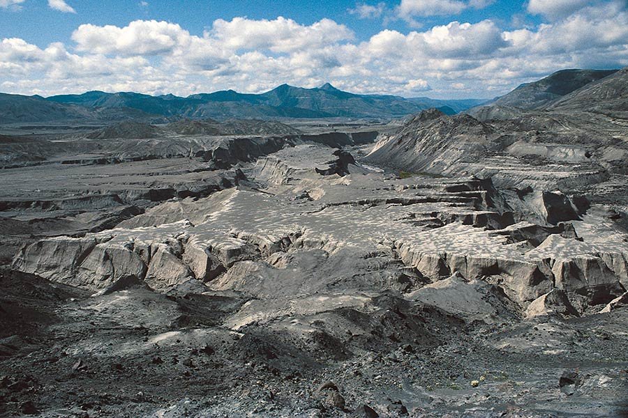
photo © Steve Austin
March 19, 1982
Another explosive eruption created destructive mudflows that cut canyons up to 140 feet (43 m) deep in a single day. “Little Grand Canyon of the Toutle River,” seen here, is a one-fortieth-scale model of Grand Canyon.
photo © Steve Austin
March 19, 1982
Another explosive eruption created destructive mudflows that cut canyons up to 140 feet (43 m) deep in a single day. “Little Grand Canyon of the Toutle River,” seen here, is a one-fortieth-scale model of Grand Canyon.
Little Grand Canyon & Other Canyons
by Andrew A. Snelling
Two major catastrophes combined to produce a mini- Grand Canyon near Mount St. Helens. During the initial blast, two-thirds of a cubic mile (2.8 km3) of rock material slid down the side of the volcano, blocking the drainage from Spirit Lake into the Toutle River. It was the largest debris avalanche observed in human history. The deposits averaged 150 feet (45 m) thick.
Nearly two years later, on March 19, 1982, the hot volcanic ash from another explosive eruption of Mount St. Helens melted a thick snow pack in the crater, creating a destructive, sheet-like flood of water and mud, which became a mudflow. Reaching the earlier deposits blocking Spirit Lake, the flow cut channels through the debris at a speed of 40 miles per hour (65 km/h). Individual canyons up to 140 feet (43 m) deep appeared in a single day. On either side of the canyons were elevated plateaus resembling the North and South Rims of the Grand Canyon.
Side canyons also appeared, resembling the side canyons of the Grand Canyon (technically known as gully-headed and amphitheater-headed side canyons). The breach did not cut straight through the obstruction, but took a meandering path, similar to the meandering path of the Grand Canyon through the high plateaus of northern Arizona. Indeed, this “Little Grand Canyon of the Toutle River” is a one-fortieth scale model of the real Grand Canyon.
This amazing feature was cut through soft debris, but another eruption two months later (on May 19, 1982) melted a snow pack that cut through hard basalt bedrock. The resulting Loowit Canyon was more than 100 feet (30 m) deep. Nearby, the avalanche cut through lava and ash layers to form a third canyon, Step Canyon, up to 600 feet (180 m) deep.
Lessons about Catastrophe
Small creeks now flow through these deep canyons. In other places, geologists assume creeks cut the surrounding canyons very slowly over a very long time period. Yet at Mount St. Helens they know that the canyons formed first and formed extremely rapidly!
Application to the Creation Model: Rapid Canyon Formation
The long timescales that geologists assign to the erosion of deep canyons are erroneous. Deep canyons could have formed very rapidly, including the Grand Canyon of Arizona, during and immediately after the Flood.
What happened at Mount St. Helens demonstrates that the sudden release of water can cut canyons rapidly, even through hard rock. Special, destructive processes are in play during catastrophes, which we don’t see every day. For instance, the mud and water flows pick up rocks, which scratch the bedrock surfaces, leaving behind grooves and striations often mistakenly ascribed to grinding, slowly moving glaciers. When the mud and water flows fast enough, it can cause cavitation, a process that generates vacuum bubbles that implode and inflict hammer-like blows that pulverize rock. Such rapid erosion processes would have operated on a much grander scale during and immediately after the Flood.
USGS
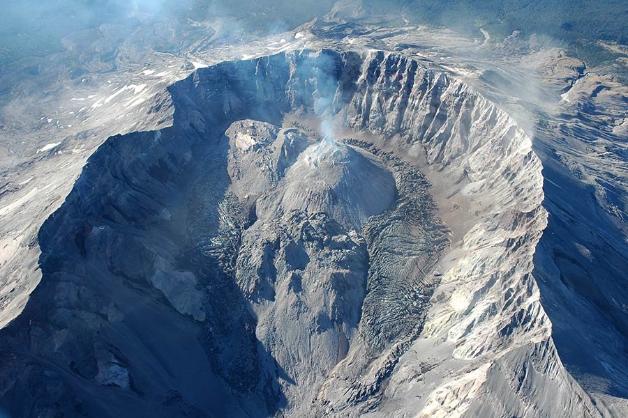
October 26, 1986
A lava dome formed between 1980 and 1986. Samples from this newly formed rock were radiometrically dated at supposedly 350,000 years old and some minerals at 2.4 million years old.
USGS
October 26, 1986
A lava dome formed between 1980 and 1986. Samples from this newly formed rock were radiometrically dated at supposedly 350,000 years old and some minerals at 2.4 million years old.
New Lava Dome with Old Radiometric Dates
by Andrew A. Snelling
When the volcano initially erupted, the top 1,300 feet (395 m) of its summit was blasted away and slid down the slopes, leaving an enormous horseshoe-shaped crater. Within days the release of pent-up pressures allowed lava to flow out of the vent so that a dome began to build and harden.
Five times in subsequent months, eruptions destroyed each growing lava dome. The sixth dome was formed in the six years between October 18, 1980, and October 26, 1986. Seventeen lava flows, consisting of more than 2.6 billion cubic feet (74 million m3) of lava, built this new dome, which towered 1,150 feet (350 m) into the air.
In June 1992 a large sample was collected from the surface of one of the last lava flows, probably from the year 1986. Samples were sent to a laboratory in 1996 to be radiometrically dated using the potassium-argon method. This method measures the amount of argon atoms that presumably formed from the radioactive decay of potassium atoms in the lava after it cooled. The rock was a mere ten years old, but the potassium-argon “clock” dated the rock at 350,000 years old, and minerals within it dated at up to 2.4 million years old.
Lessons about Catastrophe
These results are consistent with many reports in the literature of numerous other lava samples from around the world that have similarly yielded highly erroneous potassium-argon ages. This unquestionably demonstrates that the radioactive dating methods are fraught with difficulties that render them unreliable.
Application to the Creation Model: Radiometric Dating Is Based on Unprovable Assumptions about Unseen Conditions inside the Earth
If the assumptions are faulty, they can produce incorrect dates. So when we see old dates that contradict the biblical timeframe, we can be certain they are based on mistaken assumptions and must be radically adjusted.

RalphDCurtin | Thinkstock.com
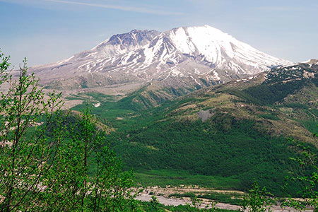
Today
The eruption and its aftermath challenged, and still challenge, the slow-and-gradual interpretation of the accumulation of sediments, the erosion of landscapes, and the recovery of environments.
RalphDCurtin | Thinkstock.com
Today
The eruption and its aftermath challenged, and still challenge, the slow-and-gradual interpretation of the accumulation of sediments, the erosion of landscapes, and the recovery of environments.
Soil Recovery at the Death Zone
by Joe Francis
The eruption of Mount St. Helens showed just how many ways a volcano can destroy once-thriving environments—from the slow death of choking ash to instant burial under rock avalanches, mudflows, or scorching 600°F (315°C) winds traveling at hundreds of miles per hour.
One landscape in particular led former President Carter to compare the desolation to a moonscape. Now called the Pumice Plain, this 6-square-mile (15.5 km2) region was scoured clean of plants and animals by the intense heat and then buried under more than six feet of sterile rocks and volcanic ash and dust (called pumice). No garden could grow in this sterile, nutrient-poor soil without the addition of new soil and lots of nutrient-rich fertilizer. Or so scientists assumed.
So biologists were quite surprised to find life returning to this pale ashen desert within a couple of years. Part of the secret was a small “soil engineer” living underground, the pocket gopher. These small rodents, often condemned for destroying suburban lawns and golf courses, were digging tunnels and mixing good soil with the nutrient-poor soil. But where did the gophers get their food?
The lone biologist studying this barren landscape noted a flowering plant, called a lupine, growing early in the recovery. But how could flowering plants grow in the sterile dust and ash without nutrients like nitrogen?
That’s where bacteria came into play. Lupines are legumes, which live closely with special bacteria that harvest nitrogen from the air. Somehow enough of these bacteria survived the high temperatures below the soil, or they traveled with the lupine seeds that blew in, or they were dropped by birds. The bacteria then took up residence with the lupines and began passing nitrogen to them.
The lupine uses this nitrogen to make rich proteins, which it packs into seeds. The plants’ nitrogen also passes into the soil, making it more fertile. The gophers could easily survive on the lupine’s leaves and nutritious seeds.
It didn’t require much, after all, to kick-start a web of life on the Pumice Plain!
Lessons about Catastrophe
It’s fun to realize how God designed lowly creatures like rodents and bacteria—which we often associate with pests and disease—to help restore His earth after catastrophes. And they don’t need much extra help to reestablish a thriving environment!
Regions outside the Pumice Plain recovered even more quickly, with the circumstances varying dramatically from spot to spot. While some kinds of environments disappeared, such as the old-growth fir trees, the number of healthy lakes and ponds increased fivefold! Biologists came away with a new appreciation for the versatility of living things, and the difficulty of predicting how many ways they can reestablish thriving environments after a single catastrophe.
Application to the Creation Model: Rapid Soil Recovery after the Flood
Creation biologists were intrigued by how fast the most sterile areas around Mount St. Helens returned to life after the 1980 eruption. Biologists had to “rewrite the books,” as it were, about the speed with which bacteria and rodents could help restore health to devastated soils.
While we often consider these creatures pests, their high reproductive rates make sense as a designed phenomenon to help restore destroyed ecosystems. Many different kinds of rodents could have reproduced rapidly on Noah’s Ark during the voyage. Without predators, these ready-made soil engineers could have spread over the earth, preparing the soil for other animals to come.
If we can be surprised by biological recovery on a small scale, we can’t even imagine all the possibilities after the Flood, which left a variety of nutrient-rich sediments and plenty of water.
Lorraine Swanson | Dreamstime.com
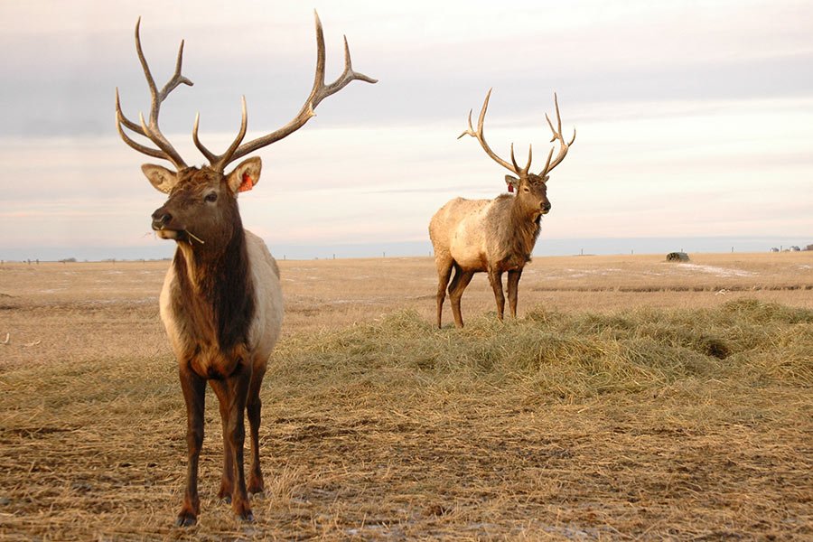
Fall 1985
Within days of the eruption, elk were already back in the blast zone searching for food. Herds flourished on the nutritious leafy plants that recolonized the region. Within five years several hundred had settled back in the region.
Lorraine Swanson | Dreamstime.com
Fall 1985
Within days of the eruption, elk were already back in the blast zone searching for food. Herds flourished on the nutritious leafy plants that recolonized the region. Within five years several hundred had settled back in the region.
Rapid Animal Recovery
by Tom Hennigan
The volcanic blast toppled 230 square miles (600 km2) of their forest home, burying all the local animals in steam, rock, and mud. How long would it take for a full complement of their forest brethren to return in sustainable numbers? Prevailing theories about ecological succession assumed it might take a century or more. Yet, amazingly, within a decade many animal species had already repopulated the Mount St. Helens area and have been gaining in numbers ever since.
The first colonists spread quickly because there were so few post-blast predators, parasites, and disease-causing organisms. Reproductive rates went through the roof. For instance, the safe conditions triggered a biological change in female elk, which began bearing twins and triplets each year, rather than their typical rate of one calf every two or three years.
This process was not always smooth, however. As predators and disease increased, some animal populations were eliminated only to later arrive again, re-establish, and remain.
Lessons about Catastrophe
Ecologists are in awe at the rapid animal recovery at Mount St. Helens. One of the greatest lessons is the impact of “biological legacies.” This refers to organisms that were shielded from the worst impacts of the eruption. Small mammals and amphibians were hidden in deep ridges, holes, or snowdrifts. Most of the 15 native species of frogs, toads, and newts survived in egg or tadpole stages, sheltered in water or shielded by natural barriers. Those who survived were able to take advantage of limited resources because they had a diversity of feeding habits: plant eaters, meat eaters, insect eaters, and scavengers.
Animals at the edges of the blast zone and beyond immigrated back as conditions permitted. Biologists were especially surprised how “incredibly mobile” small mammals were, traveling over large open distances to reach vegetation “islands” where plants had started to grow. Conventional theory assumed they needed to follow “corridors” to get from place to place, but even the tiniest animals could hike over vast tracts of barren land without much problem.
All the large mammal species that had perished in the blast—elk, black-tailed deer, mountain goat, American black bear, and cougar—quickly returned. The elks’ hooves helped break up the soil, and feces helped spread seeds and nutrients. All the animals worked together in amazing ways to restore the environments, even without conscious effort.
Application to the Creation Model: Biological “Legacies” and Islands
Can factors that allowed rapid animal recovery at Mount St. Helens indicate how the animals repopulated the earth after the Flood? It seems clear that God designed animals so that they could quickly enter a devastated region and reestablish a fully functioning environment. We describe the survivors of a catastrophe as “legacies.” Many types of plants and small creatures could have survived the Flood on floating vegetation, establishing vegetation “islands” around the globe (like the olive that the dove found). Birds and fast-moving, fast-reproducing small land animals could scatter across the planet in record time, stirring up the soil and spreading seeds, while larger animals came close behind. The succeeding decades produced wild fluctuations, as some creatures went extinct and others moved in, until the environments stabilized. That’s what we find in miniature form at Mount St. Helens today.
Just as God showed favor toward Noah, He knew the importance of biological legacies as He sheltered a diversity of air-breathing land animals on the Ark. He designed them to respond to the changing landscape, move large distances, and repopulate the planet afresh. More important, these environments would sustain Noah’s family until God could provide His greatest demonstration of grace through their descendant, Jesus Christ.
Conclusion
The 1980 eruption of Mount St. Helens provided a rare opportunity to study catastrophic processes at work. Within a few months it produced changes that scientists assumed required many thousands of years. And the environments returned to full health in just a few years, not decades or centuries. The eruption and its aftermath challenged, and still challenge, the slow-and-gradual interpretation of the accumulation of sediments, the erosion of landscapes, and the recovery of environments.
On one hand, this catastrophe challenged the uniformitarian ideas that underpin Darwinian evolution. On the other hand, it provided invaluable clues to help us understand the cataclysmic power of the Genesis Flood, and the biological designs that helped plants and animals repopulate the earth after the Flood.
holds a PhD in geology from the University of Sydney and has worked as a consultant research geologist in both Australia and America. Author of numerous scientific articles, Dr. Snelling is now director of research at Answers in Genesis–USA.
is associate professor of biology at Truett-McConnell College, where he teaches organism biology and ecology. He is co-author of the newest edition of the Wonders of Creation series, The Ecology Book.
, chairperson of the Department of Biological and Physical Sciences and Department of Mathematics at The Master’s College, earned his PhD from Wayne State University and completed a post-doctoral fellowship at the University of Michigan Medical School.
For Further Information . . .
- The 1980 Eruptions of Mount St. Helens, Washington edited by P. W. Lipman and D. R. Mullineaux.
- “Mount St. Helens and Catastrophism” by Steven A. Austin in Proceedings of the First International Conference on Creationism, vol. 1 (Pittsburgh, Pennsylvania: Creation Science Fellowship, 1986), 3–9.
- “Excess Argon within Mineral Concentrates from the New Dacite Lava Dome at Mount St. Helens Volcano” by Steven A. Austin in Creation Ex Nihilo Technical Journal 10.3 (1996): 335–343
- Footprints in the Ash: The Explosive Story of Mount St. Helens by John Morris and Steven A. Austin (Green Forest, Arkansas: Master Books, 2003).
- “Why Is Mount St. Helens Important to the Origins Controversy?” by Steven A. Austin in The New Answers Book 3, ed. Ken Ham (Green Forest, Arkansas, Master Books, 2010), chapter 26, 253–262
- Mount St. Helens: Modern Day Evidence for the World Wide Flood by Steven A. Austin and Kyle Justice (Compel Media, 2012).

RAPID COOLING
Mount St. Helens blasted enough ash into the atmosphere to blanket eleven states and cool the earth. Since volcanic eruptions were much larger after the Flood, we can see how they contributed to a rapid Ice Age.
RAPID COAL AND PETRIFIED FORESTS
The eruption destroyed the surrounding forests and produced a mat of logs floating on nearby Spirit Lake. The logs jostled together and lost their bark, producing a pile of peat (like peat in coal). Many logs floated upright and then sank in layers (like a petrified forest).
RAPID LAYERS
The volcanic blast was followed by landslides, mudflows, and falling ash. These catastrophes produced complex sediment layers up to 600 feet (180 m) thick. Several slurries of volcanic ash produced many different fine layers in just minutes.

RAPID CANYON FORMATION
The initial blast sent an avalanche into the Toutle River, depositing sediments an average of 150 feet (45 m) thick. Another eruption two years later melted snow and created a mudflow that cut canyons up to 140 feet (43 m) deep in a single day.

Related Videos
Mount St. Helens: Modern Evidence for the World Wide Flood Excerpt
Answers Magazine
April – June 2015
The eruption of Mount Saint Helens in the 1980s changed how we view catastrophe; on its thirty-fifth anniversary, we examine what we’ve learned since then.
Browse Issue
Support the creation/gospel message by donating or getting involved!

Answers in Genesis is an apologetics ministry, dedicated to helping Christians defend their faith and proclaim the good news of Jesus Christ.
- Customer Service 800.778.3390
- Available Monday–Friday | 9 AM–5 PM ET
- © 2026 Answers in Genesis