
Ancient Apocalypse Part 2: “What the Sites Mean in a Biblical Worldview”
A secular interpretation of the global flood falls short
As mentioned in part 1 of this review, we will focus a bit more on the sites that Graham Hancock visited. We’ll also delve into conventional dating for the sites, Hancock’s position on the dates, and of course the timeline of the events in a biblical worldview. We will also talk about the scientific aspects of some of the events, most notably the Younger Dryas event and where it occurs in biblical history. We’ll cover each episode in order.
Episode 1: “Once There Was a Flood”
The first two sites mentioned in Ancient Apocalypse were Gunung Padang in Indonesia and Nan Madol in Micronesia. Gunung Padang (Fig. 1) is a series of artificial terraces built vertically on a massive hill which rises about 312 feet (95 m) above the plain. Each terrace is surrounded and reinforced with a retaining wall. There are several large hexagonal andesite columns scattered about the area, as well as a total of 12 rectangular sections which appear to be memorials (or graves) of some kind (Fig. 2). Conventional archaeology has dated the site to sometime between the second and eighth centuries AD, dates which we think are consistent with the data. But journalist and series narrator Graham Hancock believes that the date of ~20,000 BC obtained by seismologist Danny Hilman Natawidjaja is the more correct one. Natawidjaja’s findings have been roundly criticized by other archaeologists and geologists and are based on single core drilling radiocarbon dates which also appear to be sketchy. While any manipulation of large stones and terracing work in such a remote location shows great human intelligence and fortitude, doing so on a natural formation is not insurmountable, nor is there the need to appeal to some nebulous “advanced civilization.”
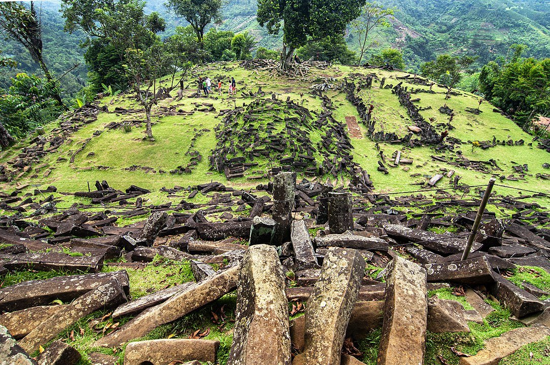
Fig. 1 Gunung Padang (Indonesia). Image credit: RaiyaniM, CC BY-SA 4.0, via Wikimedia Commons
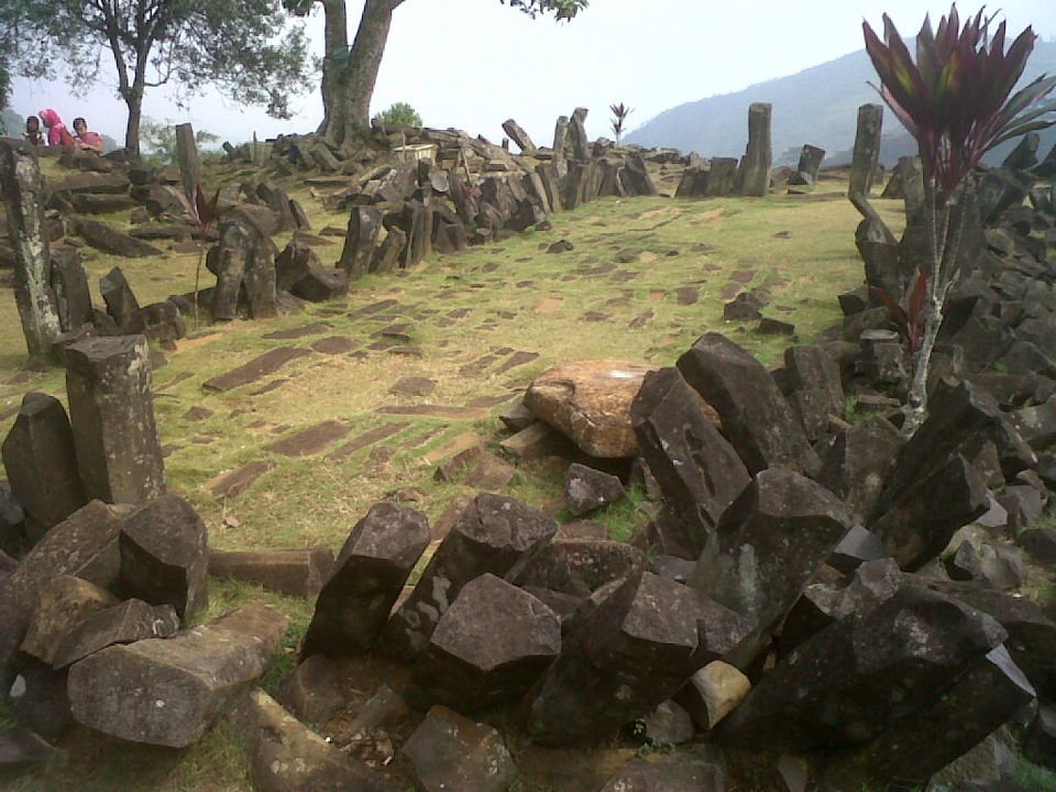
Fig. 2. Memorials at Gunung Padang. Image credit: Mohammad Fadli, CC BY-SA 3.0, via Wikimedia Commons
Hancock next visits Nan Madol in the Federated States of Micronesia (northeast of Indonesia/Papua New Guinea). This archaeological site has been dubbed the “Venice of the Pacific” because it is a series of man-made islands and canals just off the coast of Temwen Island, which itself is right off the coast of a larger island, Pohnpei (see Fig. 3). It is conventionally dated to the eighth or ninth century AD, with ongoing construction into the eleventh and twelfth centuries AD. What makes this artificial island chain even more remarkable is that there are several large megalithic structures built on each island, some of which may have been temples (Fig. 4). As impressive as these ruins may be, they do not speak to some lost civilization, but to local construction, then periods of conquest (and building) by the Saudeleur dynasty of the eleventh century to AD 1628, and then the eventual conquest by an invasion force from neighboring island Kosrae. Ironically enough, while Hancock is often looking for giants and/or demigods in the local legends, he ignores the fact that the eleventh-century invaders were considered giants and the seventeenth-century-AD leader of the conquering tribe claimed to be the son of a thunder god. Hancock, though, favors the ancient pre-10,000 BC timeline for the construction of Nan Madol, because it aligns with his end-of-the-ice-age storyline for megalithic structures worldwide.
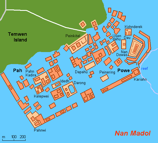
Fig. 3. Pohnpei (Micronesia). Image credit: Hobe / Holger Behr, Public domain, via Wikimedia Commons
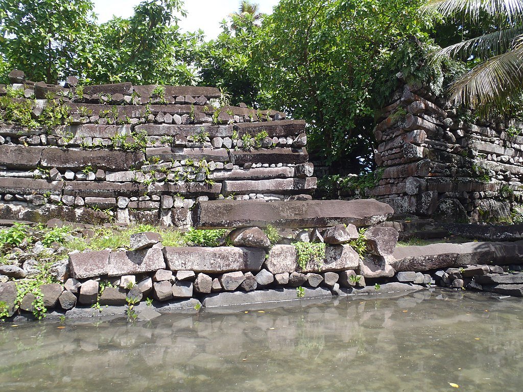
Fig. 4. Structures on Pohnpei. Image credit: Patrick Nunn, CC BY-SA 4.0, via Wikimedia Commons
Episode 2: “Survivor in a Time of Chaos”
Hancock’s next destination is the Tlachihualtepetl Pyramid in Cholula, Mexico. By volume, it is the largest pyramid in the world, although it is much smaller in height than Khufu’s Great Pyramid of Giza. Much of the pyramid has not been excavated, and interestingly, a Spanish-era church, Iglesia de Nuestra Señora de los Remedios (Our Lady of Remedies Church) built in 1594 sits atop the pyramid, which is the reason a full-scale excavation is not possible (Fig. 5). The pyramid is actually composed of six pyramids, each built atop the earlier one, with the lowest pyramid conventionally dated to 200 BC and the highest between AD 900 and 1200. Several excavation tunnels have been dug into the pyramid complex’s six layers. The pyramid/temple complex is believed to be dedicated to the Aztec god Quetzalcoatl as there are feathered serpent motifs throughout the site. Additionally, there have been a number of human remains found, many of which were human sacrifices. Some local legends claim that the site was built by giants.
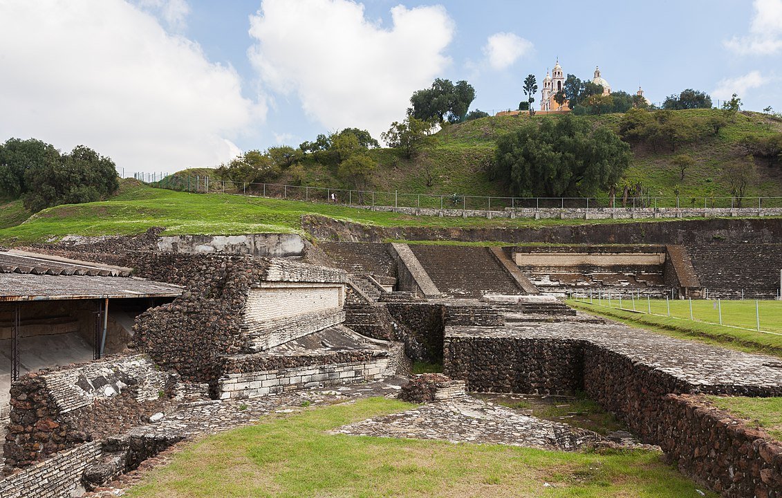
Fig. 5. Iglesia de Nuestra Señora de los Remedios atop the Tlachihualtepetl Pyramid (Cholula, Mexico). Image credit: Diego Delso, CC BY-SA 3.0, via Wikimedia Commons
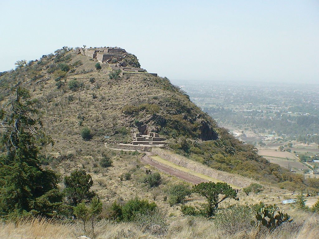
Hancock’s next site visited is Texcotzingo, which can best be described as an earthwork (man-shaped natural hill formation) that included gardens, palaces, and temples dedicated to the Aztec rain god Tlaloc (Fig. 6). The palace/gardens complex was built sometime after AD 1430 by the ruler (and artist and architect) Nezahualcoyotl of the neighboring region of Texcoco.
During this episode, Hancock mentions the theme of the benign ruler(s) of advanced civilizations traveling by boat and bestowing their knowledge of superior technology to less-intelligent civilizations. In this context, he even mentions that Quetzalcoatl may have been one such demigod. However, far more common in Mesoamerican mythos is a vengeful god who demanded human sacrifice, not a peaceful knowledge-giver.
Episode 3: “Sirius Rising”
Hancock next travels to Malta, where he visits archaeological sites Ġgantija, Ghar Dalam, and Mnajdra. His first stop was the temple complex of Ġgantija (Fig. 7). This complex consists of three temples (although the third was never completed and looks to have been barely begun) and is conventionally dated between 3600–2500 BC. Obviously, those dates are inflated as they would predate Noah’s flood. In a post-Babel biblical worldview, they would be ca. 2100 BC or younger. The site is so named because legend has it that a giantess built the complex.
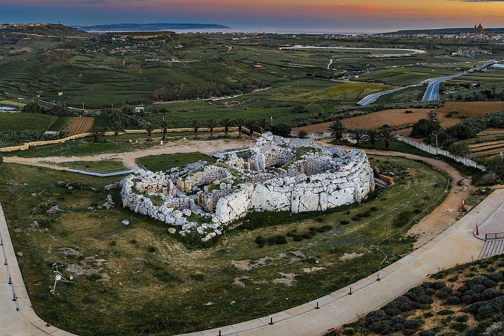
Fig. 7. Temple complex of Ġgantija (Malta). Image credit: FritzPhotography, CC BY-SA 4.0, via Wikimedia Commons
Ghar Dalam is a large “dead end” cave (Fig. 8) which contains the remains of several late–ice-age animals, which are conventionally dated to ca. 10,000 BC. Human remains, including some teeth have been dated to 7400 BC. Many of the animal remains are of animals which were from the European mainland, meaning that Malta was once connected to Sicily and Italy during the peak of the ice age when sea levels were much lower. Pottery found in the cave has been dated to 5000 BC. Hancock, though, tends to favor an even older age for the human remains and pottery and believes that humans walked across the exposed land bridges to Sicily and Malta during the ice age. He’s almost certainly right about the land bridges, but the timescale is way off, and again, in a biblical timeframe this was likely ca. 2100 BC or later.
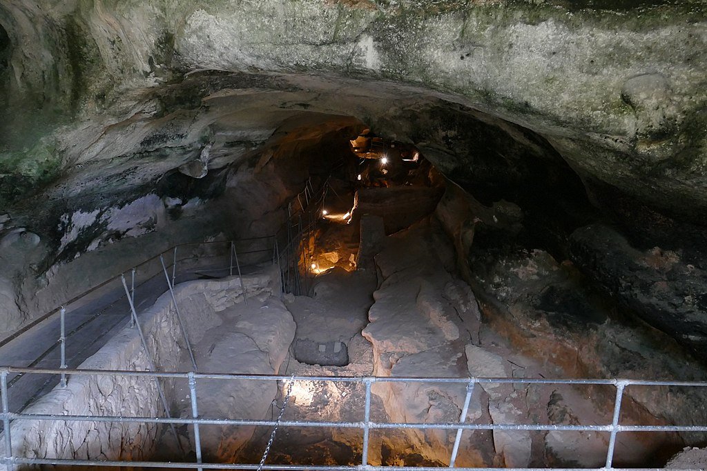
Fig. 8. Ghar Dalam (Malta). Image credit: Kritzolina, CC BY-SA 4.0, via Wikimedia Commons
The next stop is Mnajdra, a megalithic temple complex on the southwest part of the island. The complex has three temples, conjoined but not connected (Fig. 9). It is also located close to the coast, and the stones are built of large slabs of cut limestone (Fig. 10) and are dated between 3600–2500 BC. Hancock makes much of the alleged positioning of these temples to line up with Sirius. In fact, he ties this in to all the Maltese sites. As discussed in the previous article though, archeoastronomy is a field where you can force the data to fit practically any preconceived celestial alignment. But there does appear to be a deliberate attempt by the builders of Mnajdra to line the temples up with the solstices and the equinoxes.
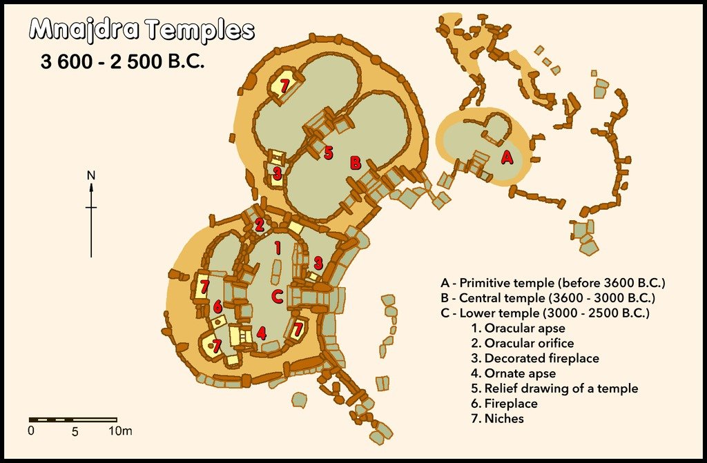
Fig. 9. Mnajdra temple complex (Malta). Image credit: Hamelin de Guettelet, Public domain, via Wikimedia Commons
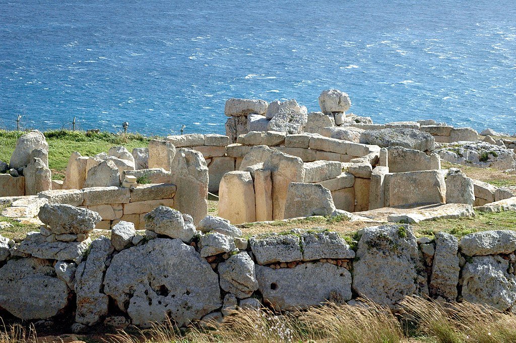
Fig. 10. Mnajdra limestone slabs. Image credit: Alecastorina93, CC BY-SA 3.0, via Wikimedia Commons
Episode 4: “Ghost of a Drowned Civilization”
In what may be the weakest episode from a content and visual perspective, Graham Hancock next travels to Bimini in the Bahamas, just off the east coast of Florida. He is here to study the Bimini Road (Fig. 11), an underwater feature that most geologists consider to be natural. Graham, however, sides with those who view it as man-made, citing such support as leveling stones placed under the road for support. In point of fact, Hancock and his fellow diver do find such stones in a few places. But if Graham wants his ideas taken seriously in scientific circles, this would be a prime opportunity to invite some marine archaeologists to dive with him and to show them these stones. It does appear as if they were deliberately placed, and to have this documented in the scientific literature by a credentialed scientist would go a long way toward getting them interested in the possibility of an earlier advanced civilization in the Bahamas.
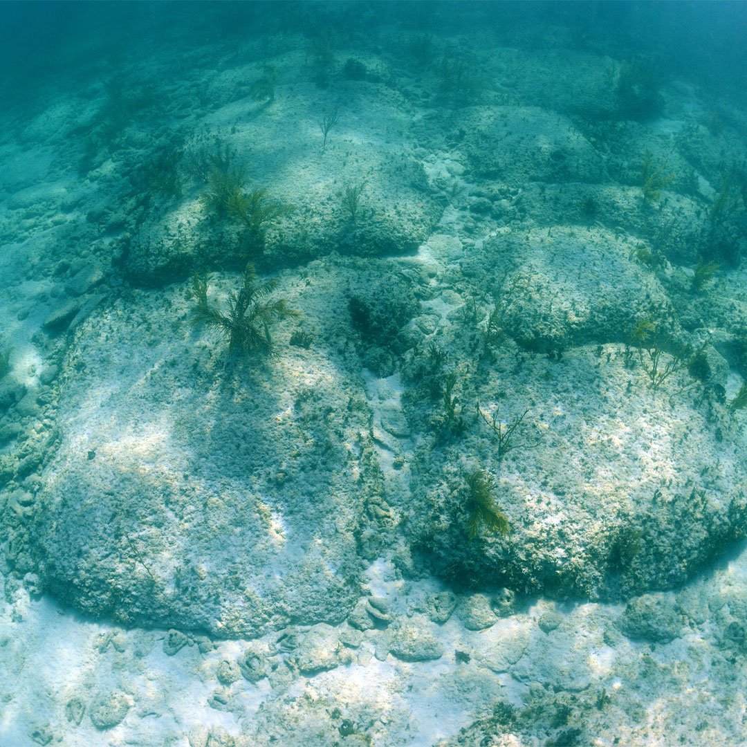
Fig. 11. The Bimini Road (Bahamas). Getty images
However, his reasons for a man-made “road” here are never fully fleshed out, as he considers them some type of navigational marker. But even if they were carved and placed by humans, they seem to have no practical purpose, except perhaps as a causeway (if they were built when sea levels were rising at the end of the ice age) or as a ceremonial cairn or rockpile.
Graham then briefly mentions Atlantis but claims that it was not in Bimini but that a few Atlantean survivors (he never shares where he believes Atlantis may have been located) may have escaped and taken their advanced technological knowledge with them and spread it around the ancient world. Then he goes on a tangent showing old maps by Piri Ries and Orontius Finaeus, which some have interpreted to show the coast of Antarctica before it was completely ice-bound or at a time when sea ice connected South America to Antarctica. Hancock believes that Plato’s mention of Atlantis is based on data his father received while traveling in Egypt, where he was told that Atlantis was destroyed by a large flood years earlier (in approximately 9600 BC). This then is his tie-in to Atlantis and Bimini and his estimation for the age of the Bimini Road.
As a side note, of the two maps, the Finaeus map is the more accurate, and even ice age researcher Mike Oard has mentioned it “is more impressive in showing the general outline of the coast of Antarctica.”1 However, Oard is less inclined to believe that these maps are based on very ancient resources but says that it is possible they were created during the Medieval Warm Period (ca. AD 900–1300), which could have caused the Antarctic ice shelves to break up, making the coast more accessible to map.2
Episode 5: “Legacy of the Sages”
Graham next travels to Turkey to visit Göbekli Tepe and Karahan Tepe. Göbekli Tepe (Fig. 12) is an impressive site and is considered to be one of the earliest post-Babel sites. Whether it was a city or just a ceremonial center is unknown and debated. But regardless, the site required a lot of manpower and planning to build. There are several T-shaped pillars (Fig. 13) as well as other large stone pillars among the six enclosures at the site, many of which contain carved depictions of animals and celestial objects. Graham seems to be fascinated by the apparent alignment of the pillars with Sirius as well as the numerous serpent motifs (including some which appear to only be squiggly lines), as does engineer Dr. Martin Sweatman, who studied pillar 43 and believes it shows asterisms (groups of stars). Conventionally dated between 9500 and 8000 BC, which Hancock seems to agree with, they can be dated to about 2150–1900 BC in a biblical timeline (early post-Babel). Hancock also mentions that in 9000 BC, the site was deliberately “buried” by being infilled with loose rock. Graham revisits Göbekli Tepe in several other episodes, so we’ll also return to cover those segments.
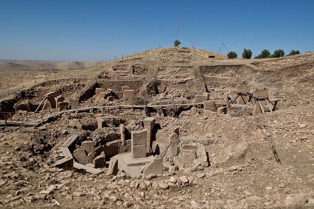
Fig. 12. Göbekli Tepe (Turkey). Image credit: Teomancimit, CC BY-SA 3.0, via Wikimedia Commons
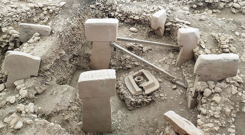
Fig. 13. Pillars at Göbekli Tepe. Image credit: Radosław Botev, CC BY 3.0 PL, via Wikimedia Commons
The next stop is Karahan Tepe (Fig. 14), 29 miles (46 km) east of Göbekli Tepe. This site also features T-shaped pillars and is dated to roughly the same time, 9500–8,000 BC (and the same biblical timeframe of 2150–1900 BC). However there is a massive human-headed snake carving sticking out of a sheer wall overlooking a pit filled with stone columns. Graham mentions that the site is connected with the Apkallu legend of the hero Oannes, a Mesopotamian half-man, half-fish demigod who instructed mankind in writing, the arts, and the sciences. As mentioned in the first article, these demigod myths may be remembrances of Noah’s sons, with the “man-fish” legend likely based on elevating Noah’s sons to gods supposedly surviving a worldwide flood by becoming fish.
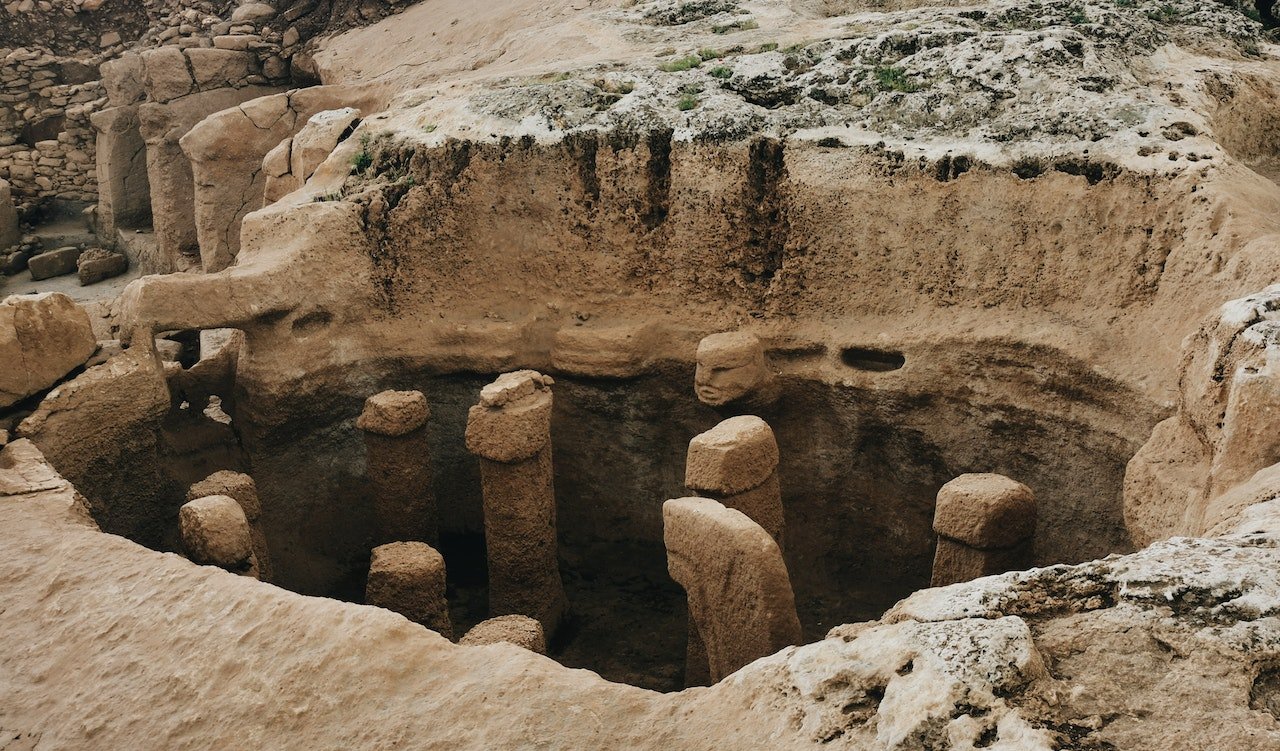
Fig. 14. Karahan Tepe (Turkey). Photo by Orthosved from Pexels
Episode 6: “America’s Lost Civilization”
Graham next visits the US, first heading to Poverty Point, Louisiana. Poverty Point (Fig. 15) is composed of six earthwork ridges and six mounds built by indigenous people between 1700 and 1100 BC. In addition, there is also an amphitheater-like plaza. The site is considered by some archaeologists to have been a ceremonial center only, while other archaeologists believe it was also a lived-in village. About 1.8 miles away is another mound, Lower Jackson Mound, which is dated much earlier at 3600 BC. Lower Jackson Mound is on the same north-south line as four of the later Poverty Point mounds, which Graham finds fascinating. Graham also believes the mounds all aligned with the solstices and equinoxes, although the on-site historian Mark Brink seems unsure about this.
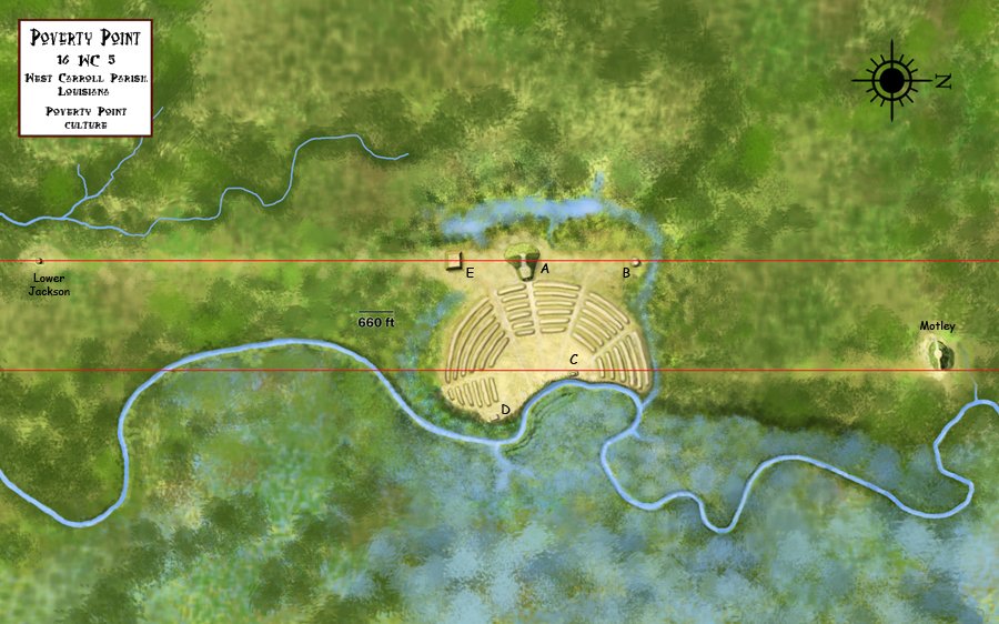
Fig. 15. Poverty Point (Louisiana, USA). Image credit: Heironymous Rowe, CC BY-SA 4.0, via Wikimedia Commons
The next location visited is Serpent Mound (Fig. 16) in Peebles, Ohio (a little over an hour from the Creation Museum), and we are immediately embroiled in a tiff as Hancock claims that his film crew has been denied entry to the site. But the reality is that he just wasn’t issued the Special Use Permit to film with his crew. They were welcome to walk around and participate like any other visitors when the park is open: they just couldn’t bring in their drones, camera gear, microphones, etc. According to different scholars, the site is either dated to AD 320 (Adena culture) or, as now appears on park signage, the site is dated to AD 1000 (and attributed to the Fort Ancient culture). This definitely irked Hancock, who believes it dates to the end of the ice age (10,800 BC) because he believes that was when the serpent’s head would have perfectly aligned with the setting sun on the summer solstice, although there is no warrant for this speculation beyond his assuming that those who built the mound must have gotten the alignment absolutely perfect (the head’s alignment with the summer solstice is off by two degrees). To close out the episode, Graham mentions that serpents play a large role in Native American legends of cataclysm.
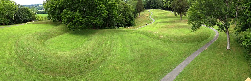
Fig. 16. Serpent Mound (Ohio, USA). Image credit: Veggies, CC BY-SA 3.0, via Wikimedia Commons
Episode 7: “A Fatal Winter”
Hancock goes back to Turkey, but this time to Cappadocia (northwest of Göbekli Tepe). His first stop is Derinkuyu (Fig. 17), an underground city beneath the village of the same name. This underground city was carved out of a relatively soft pyroclastic tuff and possibly dates as far back as the Hittite Empire (1600–1180 BC), and it is generally assumed to have been used by Christians as protection from Muslim Arabs during the Arab-Byzantine wars (AD 780–1180). There are hundreds of rooms in this city, which go down to a depth of 85 m (278 feet), and they have been estimated to be able to house 20,000 people. Whether they originally were built by Hittites hiding from Kaskians (1500 BC) or Phrygians or Assyrians (1200–1180 BC) or perhaps even later by Phrygians and Kaskians hiding from the then-dominant Assyrians (800 BC), it seems likely that they were defensive fortifications, meant to whisk people away to safety from invaders. Hancock even mentions that underground tunnels have been used successfully in warfare (mentioning the Viet Cong as modern examples) but then dismisses the idea because he believes the tunnels were built to hide from ecological disasters occurring (you guessed it) at the end of the last ice age during the Younger Dryas Event (which he dates at 9800 BC).
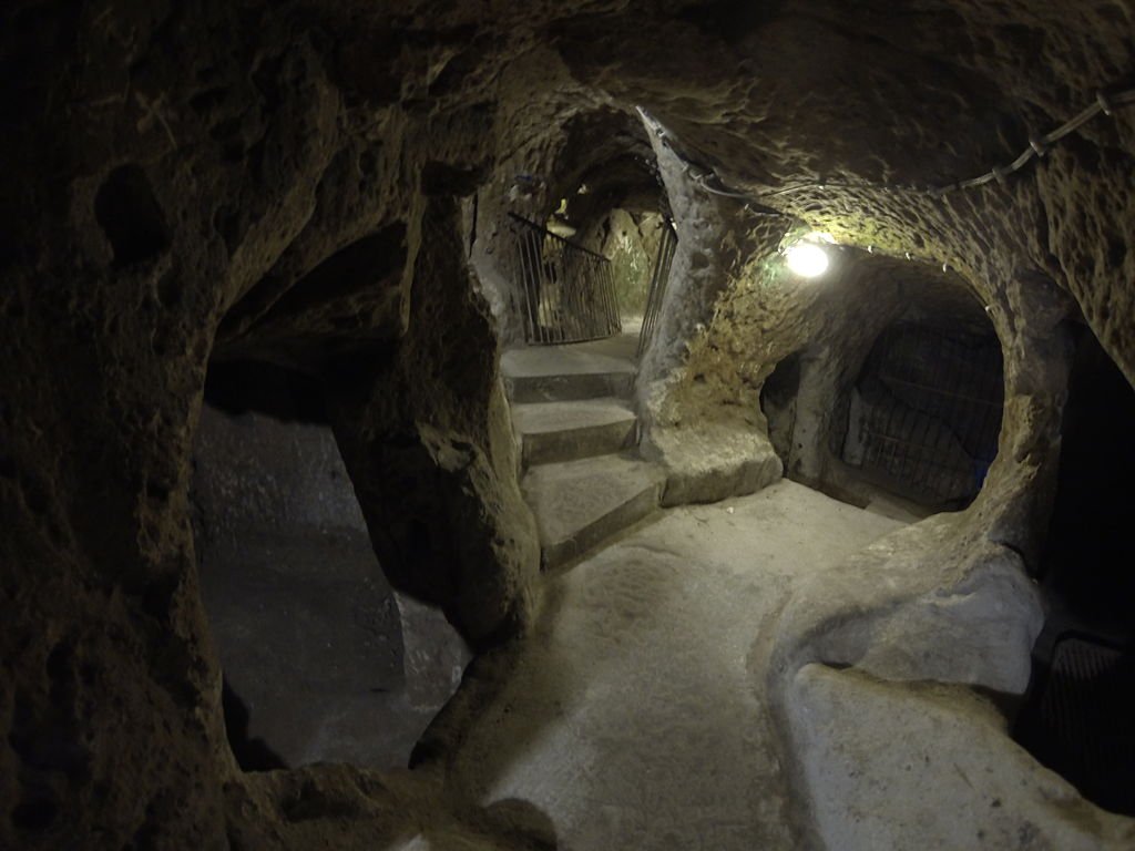
Fig. 17. Derinkuyu (Turkey). Image credit: © Nevit Dilmen, CC BY-SA 3.0, via Wikimedia Commons
Graham travels about five miles to Kaymakli (Fig. 18), another underground city. Here Graham mentions a tie-in to a Zoroastrian text on the hero Yima, a Noah-like figure. Yima (also known as Jamshid) was instructed by the god Ahura Mazda to build an underground city named Yara (or Vara) for humans, animals, and plants to survive a coming deadly winter. Yima was to take two of every creature, many people, food for their survival, and many plants and seeds to this underground city. After many floods occur all over the world, an ice age begins, but Yima and those inside the underground city survive.
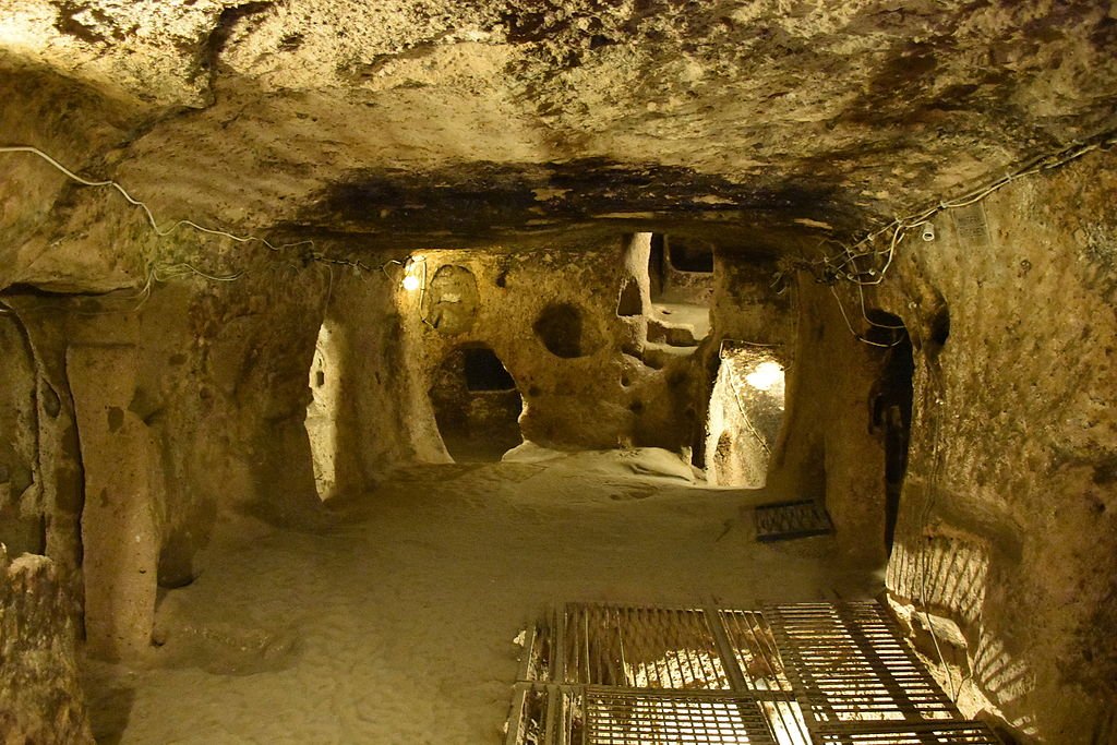
Fig. 18. Kaymakli (Turkey). Image credit: MusikAnimal, CC BY-SA 4.0, via Wikimedia Commons
Because Hancock thinks this legend is more than a legend and likely the real cause of these underground cities being built in Cappadocia, he reckons them being built just before the Younger Dryas Event when the ice age supposedly became much more severe for a brief period before giving way to the current climate. (Curiously, Hancock seems to date the Younger Dryas to 10,800 BC–9800 BC, but most geologists now date it from 10,900–9700 BC). Lastly, Hancock teases a connection between comet impacts (he believes “sky serpents” are the pictorial representation of comets in many of the sites he’s visited) and the onset of the Younger Dryas. He’ll dive into the Younger Dryas Impact Hypothesis (YDIH hereafter) in the next episode.
Episode 8: “Cataclysm and Rebirth”
Hancock next travels to eastern Washington State to visit the Channeled Scablands (Fig. 19). This is by far the most scenically beautiful episode, with vast panoramas of the Washington wilderness, including the Grand Coulee canyons. Hancock meets with architectural designer and mathematician Randall Carlson as they discuss the cause of the Channeled Scablands. In this segment, Hancock and Carlson are much more in line with YEC geologists as to the sequence of events (although not in the dating of them). Hancock and Carlson both believe a single large flood occurred at the peak of the ice age when a volume of water about 2,220 cubic kilometers (540 cubic miles), three times the volume of Lake Erie, burst through its ice dam in northern Idaho (and they also mentioned there may have been further ice dam blockages farther north in Canada which contributed to this event) and swept through eastern Washington into northern Oregon and out into the Pacific Ocean. Creation researchers would place this event ca. 2000 BC and believe that the Lake Missoula Flood was a one-time cataclysmic event that carved out the Scablands in days. Most secular models favor multiple ice dam bursts over a period of 1,400 years or so, but the evidence argues against that model.
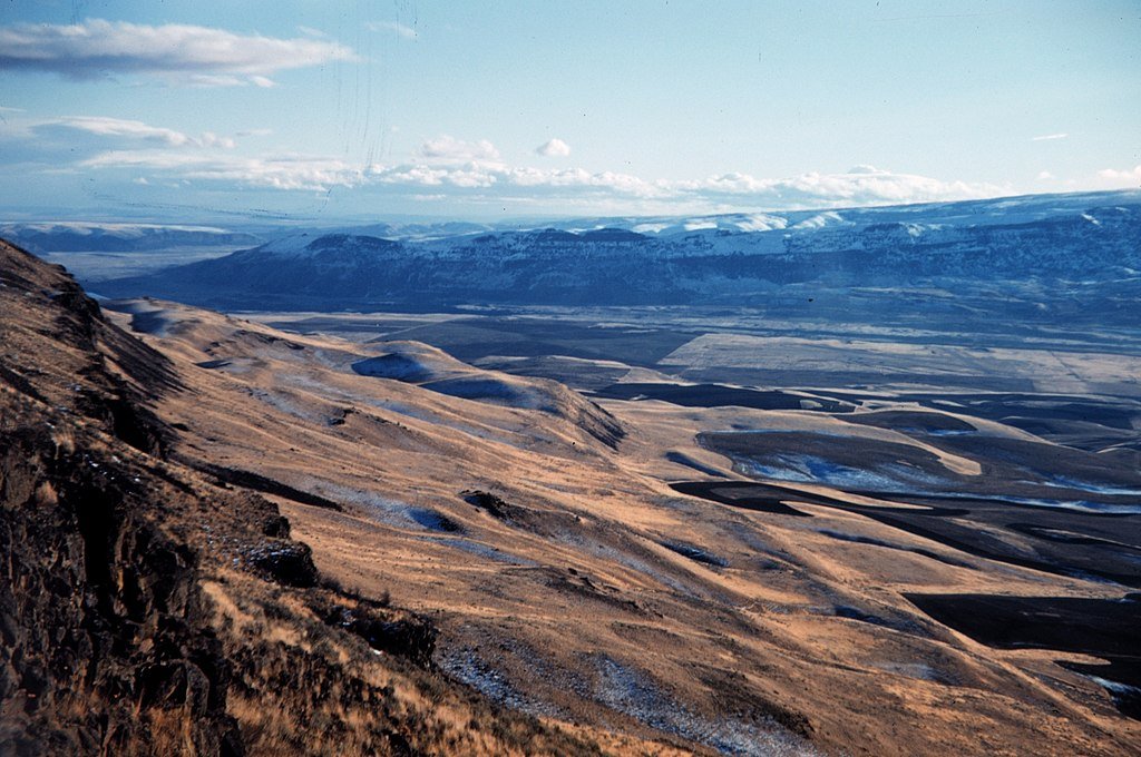
Fig. 19. Channeled Scablands (Washington, USA). Image credit: Harley D. Nygren, Public domain, via Wikimedia Commons
Hancock next travels to Murray Springs, Arizona (Fig. 20), which is interpreted as a Clovis hunting site where Native Americans hunted mammoths. Hancock, though, believes that the site is also one of over 50 in the US that point to an impact origin for the Younger Dryas. The support cited by Hancock (and to be fair, there are a sizable minority of geologists and paleoclimatologists who subscribe to the YDIH, and it does seem that a reversal of the warming trend [the Younger Dryas] late in the ice age did occur, which might or, more likely, might not have been caused by comet impacts) is the presence of black mats at the site. And Murray Springs and similar sites have reported materials including nanodiamonds, metallic micro-spherules, carbon spherules, glass spherules, iridium, and platinum within those black mats. However, while the presence of iridium sometimes can be attributed to comet/meteor impacts, volcanism can also produce iridium layers, as well as platinum and various spherules, and we know there was massive volcanism, particularly in North America (e.g., Yellowstone National Park) in the centuries following the flood as the earth settled down geologically.
Fig. 20. Murray Springs (Arizona, USA). Image credit: Ammodramus, CC0, via Wikimedia Commons
Hancock then states that over 50% of the population of the Northern Hemisphere and almost all of the ice age megafauna were wiped out ca. 9800 BC by this Younger Dryas catastrophe, yet he fails to explain why meteor impacts would selectively leave smaller mammals unaffected. Indeed even large animals like bison and bears seem to have been unfazed by this cataclysm.
Wrapping Up
Hancock certainly embraces catastrophic events during the ice age but accepts the evolutionary timetables and is selective of his data, only favoring what he already accepts as “countercultural” interpretations that fit into his narrative. This creates many very forced and tenuous connections between unrelated peoples and places. While it may be refreshing to see someone outside the YEC community regarding cultural myths surrounding the flood, ice age, and post-babel migration as having a basis in fact, sadly, Hancock ignores the true scriptural accounts behind those myths. Yes, there was a flood (a worldwide one), an ice age, and many post-flood catastrophes which are retained in human memory and which have become legendized. And lastly, yes, there is a Book which tells us exactly what happened from the most trustworthy eyewitness of all, the Creator God of the Bible. There is no need to appeal to a roving “advanced civilization” which taught mankind how to go from hunter-gatherer to farmer to city-builder. Mankind was created with this knowledge and began life as farmers and herdsmen, building cities within the second generation. Therefore, mankind never totally lost advanced technologies (although some people groups leaving Babel may have been slightly disadvantaged by climactic conditions or by being less technologically savvy than other groups).


Footnotes
- Michael Oard, reply to letter to the editor, Journal of Creation (previously TJ) 16, no. 2 (August 2002): 61–62, https://dl0.creation.com/articles/p026/c02616/j16_2_61-62.pdf.
- Oard, reply.

_5.jpg)
.jpg)
.jpg)
Support the creation/gospel message by donating or getting involved!

Answers in Genesis is an apologetics ministry, dedicated to helping Christians defend their faith and proclaim the good news of Jesus Christ.
- Customer Service 800.778.3390
- © 2024 Answers in Genesis